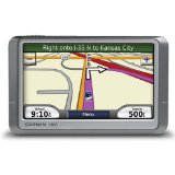
Difference Between GPS and GIS
Are you trying to look for something? Do you find it troublesome just looking for someone within a specific area ? Well, today this problem is slowly seeing its end. With the advent of modern gadgets and advanced technology, finding something or someone has never been this easy. Especially if you are using devices such as a GPS and GIS, you can really find what you are looking for quickly and completely hassle free. But what’s the difference between a GPS and GIS?
As a start, GPS (completely known as Global Positioning System) is one of the ways to precisely pinpoint specific locations in almost any place on the planet. Simply, it is a network of satellites that determines specific coordinates on earth. This network usually operates by the transmission of certain radio signals from the said satellites into the GPS receivers on the planet using the process known as trilateration. Using the U.S. government’s advanced tracking satellite technologies, the GPS system can also locate coordinates with the combination of multiple GPS satellites, receivers and oftentimes a processing circuit for data.
This technology was first developed for the purpose of the U.S. military, but little did they know that this invention could one day revolutionize how people look for what they are trying to find. The GPS has now been used in practical day to day applications and makes life easier. At present, this system is being used universally to navigate, to map an area and even to survey a specific geographical location.
On the other hand, GIS is frequently confused with GPS because it is a more generic acronym (Geographic Information System) used to describe a more complex mapping technology that is connected to a particular database. Because it’s generic, it is a broader term than the GPS in its technical sense. Thus, GIS is a computer program or application that is utilized to view and handle data about geographic locations and spatial correlations among others. It simply gives the user a framework to obtain information.
Overall, the difference between a GPS and a GIS can be summed up:
1. The GPS (Global Position System) is a network that locates certain places here on earth whereas the GIS (Geographic Information System) is a computer program that process data linked to certain places or locations.
2. The GIS is a more generic framework compared to the specific GPS network.
- Difference Between Plant Protein and Animal Protein - March 7, 2024
- Difference Between Crohn’s and Colitis - March 7, 2024
- Difference Between Expression and Equation - March 7, 2024


this thing a very very good intiative so continiosly
Hii..
This is Very useful site.. to find any different .. Thnx 2 admin…
I want 4 differences