Difference Between Indian Ocean And Arabian Sea
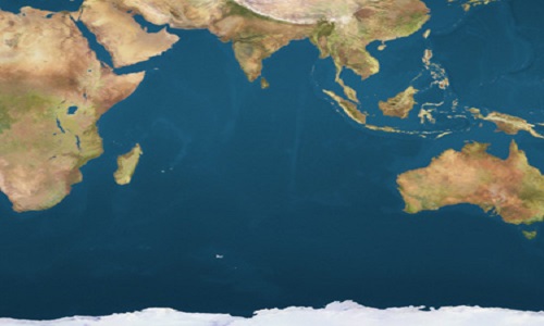
The Indian Ocean separates India, from Africa, and is named after India. It is the third largest ocean in the world; occupying 68.556 million sq. kms of area, which is 20% of the total water mass of the Earth’s surface. In ancient Sanskrit literature, it was known as Ratnakara, meaning the mine of gems, and is called Mahasagar in Hindi and other Indian languages. The Indian Ocean is the warmest of the oceans, and is bounded by Asia on the north, Africa on the west, Australia in the east and Antarctica on the south. Arabian Sea is only a part of the Indian Ocean that is located between the Arabian Peninsula and the Indian subcontinent. It lies on the northwestern part of the Indian Ocean, covering an area of 3,862,000 square km. Arabian Sea formed the main sea route between India and Europe. During the period of Roman Empire, its name was Erythraean Sea. It is surrounded by the Horn of Africa and the Arabian Peninsula on the west, Iran and Pakistan on the north, India on the east, and the remaining part of the Indian Ocean, on the south.
Indian Ocean
The history of the Indian Ocean based on cultural and commercial exchanges dates back to seven thousand years, when a network of trade relations began in the Persian Gulf, the Red Sea, and the Arabian Sea. It later developed into large human settlements within specific geographical territories along the Indian Ocean regions, and as on today, its littoral belt has 36 States with more than 10 billion inhabitants. It, being the youngest of all oceans, was considered decades ago as a “neglected ocean”, have now become the hub of political and military activities. During the past few years its regions have emerged into greater economic, political and strategic importance.
The demarcation of the borders of the Indian Ocean brought uncertainty, subsequent to the intervention of the International Hydrographic Organization in 1953, followed by the delineation in 2000, by separating the Southern Ocean and removing the waters south of 60°S and replacing it with the northern marginal seas. However, a clear and logical approach considers its border as lying with the Atlantic Ocean, and along the Cape Agulhas at the southern tip of Africa, to the south from the 2000 meridian up to the waters of Antarctica.
The Indian Ocean makes the major sea routes linking the Middle East, Africa, and East Asia to Europe and the American continents. It is through this route that the petroleum and by-products from the Persian Gulf and Indonesia are carried to the other parts of the world. It is estimated that one third of the total cargo in the world marine trade ship through its waters. During the Indian Ocean Dipole, the waters of the eastern half will cool down more than the waters of the western half, causing strong winds from east to west, at the equator.
Arabian Sea
The Arabian Sea was originated 50 million years ago when the Indian subcontinent collided with the continent of Asia. Most parts of the sea are above 9,800 feet deep. It is interesting to note that the deep water levels and the seabeds of the Arabian Sea are very similar to the land formations we see around. The medieval Arabs called it the Sea of India. Water transport along the Arabian Sea started prior to the Roman Empire, but it gained importance in the ninth century, when the Arabs and Persians began using it to connect the neighbouring communities. Realizing the way how the wind blows on the sea, they navigated to the southern parts of Arabia, East Africa and the ports of Red Sea.
The Arabian Sea, with its strategic location, has become one of the world’s busiest shipping routes. The Arabian Peninsula and the west coast of the Indian subcontinent are blessed with large deposits of petroleum and natural gas. One such deposit on the continental shelf off the west coast near Mumbai in India, are intensively being exploited, now. During the first half of every year (i.e., from July to December), the moisture laden winds from the regions of Arabian Sea blow from the southwest, causing heavy rainfall in the Indian coastal regions. The winds blow in the opposite direction in the next half, though their strength is drained.
- Difference Between Root Beer and Sarsaparilla - November 18, 2015
- Difference Between Muffler and Exhaust - November 9, 2015
- Difference Between Mace And Pepper Spray - November 9, 2015
Search DifferenceBetween.net :
Leave a Response
References :
[0]https://books.google.co.in/books?id=i0veBQAAQBAJ&pg=PT1007&lpg=PT1007&dq=Indian+ocean+is+su rrounded+by+Antarctica,+australia,+asia&source=bl&ots=OWE9N- NAix&sig=7V8bi0NDje1vIusM_FjTlOiwDOY&hl=en&sa=X&ved=0CC8Q6AEwBGoVChMIqITvkOu0y AIVBQOOCh3rLgz6#v=onepage&q=Indian%20ocean%20is%20surrounded%20by%20Antarctica% 2C%20australia%2C%20asia&f=false
[1]http://www.newworldencyclopedia.org/entry/Arabian_Sea
[2]http://www.britannica.com/place/Arabian-Sea
[3]http://www.whoi.edu/oceanus/feature/monsoon-winds-and-carbon-cycles-in-the-arabian-sea
[4]http://www.ldeo.columbia.edu/news-events/shift-arabian-sea-plankton-may-threaten-fisheries
[5]"Arabian Sea." The Columbia Encyclopedia, 6th ed.. 2015. Encyclopedia.com. 8 Oct. 2015
[6]https://commons.wikimedia.org/wiki/File:Indian_Ocean_satellite_image_location_map.jpg

